
General Economic Geography Tips
How to Approach the Study of Economic Geography in University
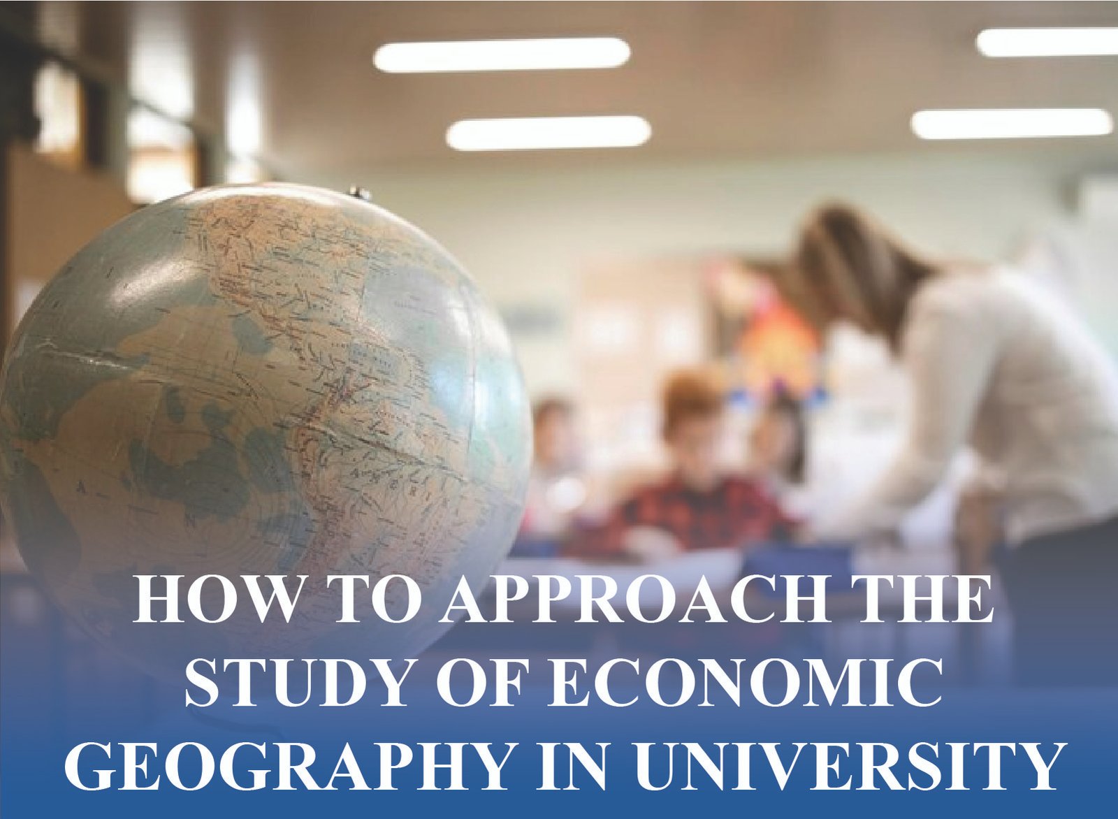
Economic geography is a dynamic discipline which studies the distribution of economic activities in space and why some regions are doing very well whilst others are poorer. Being a university student, the knowledge of economic geography will provide you with the analysis tools to assess global tendencies, regional development, and the spatial arrangement of industries. It is the science that intersects geography and economics and provides the understanding of globalization, urbanization, and the effects of technology on the economic environment. When entering the field of economic geography in college, it is a combination of theoretical knowledge, practical skills, and critical thinking that is required.
You can find the best tips in this guide on learning economic geography, including understanding the basics and using technology, such as GIS. I will discuss the most frequent challenges to students, curriculum trends, and practical tips on how to succeed in academics and career. This article will guide you to your university studies with certainty and clarity whether you are new to the topic or you want to sharpen your knowledge.
What Is Economic Geography and Why Study It in University?
The key to academic success is to understand the nature of economic geography. This discipline studies the organization of economic activities in various spaces and scales, such as local communities, and in the world economy. Economic geography studies in a university offer a special insight into such issues as regional development, spatial inequality and consequences of globalization. It also contributes to interdisciplinary thinking, which refers to economics, sociology, and environmental studies. Students can acquire useful analytical skills by asking questions such as why industries cluster, how trade networks develop, and why some regions have more advantages than others.
What Are the Core Concepts in Economic Geography?
Economic geography is the study of place, scale and spatial distribution in order to explain why industries cluster in particular areas, the variation in regions and the overall economic patterns around the world.
- Location theory demonstrates the clustering of industries and minimization of transport
expenses. - Scale analysis involves the comparison of local, regional and global economic relationships.
- Spatial distribution emphasizes the dispersion of industries, population and resources.
How Does Economic Geography Differ from Other Geography Branches?
Economic geography focuses on economic activities and human-induced spatial processes as opposed to physical geography or environmental geography, which is interested in natural systems.
- Research areas, trade, and economic growth by region.
- Combines economics, sociology and politics with space analysis.
- Describes how spatial inequality is an economic system and policy-driven phenomenon.
Why Is Economic Geography Relevant in the Modern World?
Economic geography has an influence on policymaking, urban planning, and trade through examining how globalization, spatial inequality, and technological influence economic development.
- Favors the planning of sustainable regional development and infrastructure.
- Determines the effects of globalization on regions and industries.
- Fight inequality using resources and space analysis.
What Are the Main Theories in Economic Geography?
The central place theory and core-periphery models are the key theories that aid in explaining settlement hierarchies, the effects of globalization, and the uneven development.
- Central place theory describes the systems of cities and the distribution of the market.
- Core periphery models emphasize inequality and uneven development all over the world.
- New economic geography examines the changes in the world and technology.
How Do Universities Structure Economic Geography Courses?
University degrees combine theory, thematic courses and practice and equip students with the skills necessary to work in policy, planning and research fields.
- Principles courses bring out theories, terms, and history.
- Globalization, urbanization and regional studies are in thematic modules.
- The applied economic geography learning is supported by fieldwork and case studies.
How to Build a Strong Foundation in Economic Geography
The first step in economic geography is to have a good grounding in the concepts, theories and terminology that are fundamental to the subject. In university classes, students are usually exposed to the spatial structure of economies, the place of location, and the influence of distance and accessibility. The foundation of this base is essential to comprehending more complex subjects and using the knowledge in practice. In this section, you will be taken through the best study practices, tools that you need to study, and how to approach both the theoretical and practical side of the field. With the emphasis on the basic skills, you will be more prepared to complete complicated tasks, engage in discussions, and do your own research.
What Study Resources Are Essential for Economic Geography?
Students require textbooks, journals and web platforms to develop theory and practice.
- Core textbooks will be utilized to cover the basic theories, examples, and practice.
- Get peer reviewed journals to develop debates and current economic studies.
- Search in GIS tutorials and online mapping and spatial analysis courses.
How Can You Master Key Terminology and Concepts?
Good vocabulary is a guaranty of understanding. Repetition, practice and teamwork enhances retention and practice.
- Make flashcards to memorize theories and concepts and terminologies.
- Form study groups where they can share knowledge with their peers through peer discussions.
- Use language in essays, projects and real life economic case studies
What Are Effective Note-Taking and Study Techniques?
Mind maps and summaries are some of the effective techniques that enhance retention and conceptual understanding.
- Connect the concepts, theories and real world examples using mind maps.
- Restate lectures in briefs with easy to understand language.
- Note-taking should be reviewed and revised on a regular basis to ensure long-term retention.
How to Approach Quantitative and Qualitative Methods?
Quantitative and qualitative approaches are also needed in equal measure, with numbers and stories to give a complete analysis.
- Understand spatial data, charts, and statistics with the help of GIS and Excel.
- Interview and survey to collect qualitative economic geography information.
- Integrate the two in order to have balanced economic geography research projects.
How to Connect Theory with Real-World Applications?
Theory is important when it is applied in real world projects, internships and case
studies.
- Examine local urban planning or local economic development projects.
- Engage in field trips, GIS laboratories or computer-based economic simulations.
- Connect academic theories with the current global economic problems.
What Are the Key Challenges and How to Overcome Them?
The field of study of economic geography at university may be intellectually stimulating, but it has its own challenges. The students are usually faced with abstract spatial models, complicated data analysis, and multi-disciplinary integration. It can be overwhelming to keep up with the changing theories and implement knowledge in practical problems. In this section, the most frequent barriers to students will be touched on and solutions to them provided in a practical way. Whether it is coping with the bulky reading workload or learning the GIS software, you will find practical tips and practical advice on how to make the learning process more positive. These challenges can be overcome by foreseeing them and thus ensuring that in the process of studying economics geography in the university, you can make the most out of it.
How to Tackle Abstract Spatial Concepts?
Abstract models are challenging. Complex geographic theories can be made simple to students by use of visual tools, real world analogy, and group discussions.
- Draw diagrams which reduce complicated spatial theories to visuals which are easy to comprehend.
- Make comparisons between abstract models and something familiar to the real world.
- Actively discuss with professors, tutors and peer study groups about theories.
What If You Struggle with Data Analysis?
Analysis of data is not easy and through regular practice, workshops and peer work, students gain confidence and competence.
- Work through sample GIS to enhance analysis and mapping.
- Participate in software training (e.g. Excel, R or GIS).
- Work together on projects in order to exchange techniques and data knowledge with others.
How to Balance Theory and Practice?
Theory-practice balance guarantees an association between concepts and applied education, professional competencies, and academic achievement.
- Practice theories in essays, projects, and research case studies.
- Engage in internship programs in order to acquire professional experience and practical skills.
- Consider fieldwork as a means of enhancing knowledge of theoretical frameworks.
How to Stay Updated with Evolving Theories?
To keep up to date, journals, blogs, and academic events are needed to provide a current view and debate.
- Get subscription to major geography journals and newsletters to get recent discoveries.
- Subscribe to academic blogs, podcasts or university research networks on the internet.
- Participate in conferences and guest lectures to learn about debates.
How to Manage Workload and Stay Motivated?
The discipline, time management, and motivation strategies to balance heavy work loads would also be required in order to have a consistent progress.
- Divide big tasks into smaller and attainable tasks and milestones.
- Get regular rest periods to de-stress and increase concentration.
- Reward academic improvements to keep the momentum going.
What Tools and Skills Are Essential for Success?
Economic geography is not just a field of study that one can succeed in without being equipped with theoretical knowledge; it entails an individual who is familiar with digital tools, analytical abilities and can communicate effectively. The application of Geographic Information Systems (GIS), spatial analysis software and data visualization systems is becoming more popular in universities. These technical skills are useful in developing the capability of interpreting complex data and the presentation of findings in an easy manner. In this part, the author has highlighted the key tools and skills that every economic geography major must have, including GIS fundamentals, research design, and writing academic papers. You will also be in a good position to excel in your studies as well as in your future employment opportunities by developing a multifaceted skill base.
What Is GIS and Why Is It Important?
GIS plays a crucial role in mapping and analysis of economic trends, and is important in academic studies and professional planning.
- GIS to examine the spatial patterns, industries, and distribution of resources.
- Use GIS expertise in urban development, policy and planning.
- Draw diagrams to illustrate research and make research understandable.
How to Develop Strong Analytical Skills?
Analytical skills also help students to critically interpret data to enhance the quality of the research and the possibilities of employability in various disciplines.
- Training in deriving datasets of economic and geographic research projects.
- Apply statistical tools such as R, Python or SPSS.
- Critically review academic articles to enhance academic thinking.
What Communication Skills Are Needed?
Effective communication improves academic writing, presentation and teamwork both at work and in academics.
- Prepare clear, structured and concise essays and academic reports.
- Show current results in the form of charts, graphs, and digital maps.
- Attend seminars, discussions, and working in groups.
How to Design and Conduct Research Projects?
It is a good study that should have a well-designed research, proper questions, and proper implementation of methodology and analysis.
- Establish research questions that are well defined and with objectives.
- Gather spatial or economic data through research methods that are correct and reliable.
- Current evidence in oral presentations and prepared written reports.
What Are the Benefits of Fieldwork and Internships?
Fieldwork and internships help to bridge the gap between theory and practice in classrooms and enhance employability and applied skills.
- Put theoretical knowledge into practical projects in real life.
- Establish contacts with professionals on internships and research placements.
- Acquire hands-on skills which improve resumes and career prospects.
How to Leverage University Resources and Plan Your Career
The best way to make the most out of your university life is to use what is available and strategize on how to move on with your future life. Economic geography programs have plenty of services, including academic advising, research centers, and student organizations. Talking to faculty, participating in seminars, and extracurricular activities can help make your learning more rich and provide opportunities into professional life. This section offers tips on how to maximize university resources, career search, and networking in the sphere. Actually, whether your goals are either an urban planning position, policy analysis, or even a teaching career, strategic planning and active processes will put you on the right track towards achieving success in economic geography.
What University Resources Support Economic Geography Students?
Universities offer advising services, libraries and societies that assist in academic growth and student achievement.
- Use access advising services, mentoring programs, and peer tutoring on a regular basis.
- Research with the help of university libraries and databases on economic and spatial research.
- Network through joining geography clubs or student organizations.
How to Network with Faculty and Peers?
Networking promotes mentorship, research and working together with peers and faculty members.
- Active participation in office hours to consult and get academic mentorship.
- Work in groups or with classmates on projects, research or group assignments.
- Establish networks during departmental events, talks and academic conferences.
What Are the Top Career Paths for Graduates?
Graduates are employed in planning, GIS, consulting and academia, and use geographic and economic knowledge.
- The practicality of spatial analysis is needed in the roles of urban and regional planning.
- The GIS analysis profession is expanding both in the government and in the business sector.
- The careers of policy consulting are interdisciplinary in nature.
How to Prepare for Graduate Study or Research?
- Graduate study needs to be prepared using research opportunities, networking and faculty mentorship support.
- Engage in research work as an undergraduate to develop academic skills.
- Go to academic workshops, conferences on geography, and research.
- Get faculty advice on graduate applications and career planning.
How to Stay Engaged with the Field After Graduation?
Constant interaction guarantees professional development. Graduates are kept in touch through networking, associations, and lifelong learning.
- Becoming a member of the professional associations such as RGS, AAG, or local networks.
- Get updated information by subscribing to journals, newsletters and blogs.
- Reach alumni and professionals via events and webinars.
About the Author
I am Dr. Adrian Clarke, a lecturer and researcher in economic geography having an experience of more than ten years teaching and conducting research work on the urban development, spatial inequality, and the role of technology in the economic landscapes and I have also mentored students in GIS, spatial analysis, and research methodology workshops and assisted them in linking theory to practice. I have published my work in peer-reviewed journals and participated in the discussion of regional policy. Also I rely on teaching methods that are based on empathy in education which were inspired by the Stanford studies to develop interesting learning environments. Outside of the classroom, I like building reading lists and facilitating academic writing groups in geography students.
Conclusion
Economic geography is the study of economic patterns and regional dynamics of the world, and it provides a unique perspective in studying the world in a university. With the ability to acquire the essential ideas and gain technical proficiency and utilize the university resources, you can succeed in school and become a professional in a fulfilling career. Always take up a challenge as a growth opportunity, never stop questioning and be a hands on learner with theory and practice. The field of economic geography is a fulfilling and valuable experience to pursue with the right attitude.
Willing to study economic geography at university? Get them started and start today, search through our suggested materials, meet with professionals, and put your studies to the test!
FAQs
1:What is economic geography in the university?
Economic geography is the discipline of the organization of economic activities in space – industry clusters, trade flows and the development of regions.
2:What are the key issues of economic geography courses?
The location theory, regional development, globalization, spatial inequality and use of GIS to analyze space are all common courses. Case studies and economic problems of the real world are also studied by students.
3:What can I do to be successful in the field of economic geography at university?
Learn theory and practice, master data analysis, engage in discussions and get assistance when necessary. It is also useful to use GIS and keep abreast of the latest trends.
4:What are the skills required by economic geography students?
Spatial analysis, critical thinking, data interpretation, GIS skills, and communication are among the most crucial skills. The skills are useful in achieving academic success as well as careers.
5:What is the relationship between economic geography and other fields?
Economic geography is chiefly interdisciplinary with economics, urban planning, environmental studies, and political science, contributing spatial insights to interdisciplinary research and policy.
6:What are the career opportunities of the economic geography graduates?
Urban planning, GIS analysis, policy research, consulting, and academia are some of the careers that graduates can take up. Analytical and spatial abilities that have been acquired are very desirable in various industries.
7:What are some of the pitfalls of economic geography?
Spatial models and data analysis are not always easy among the students. Often encountered hurdles are balancing theory and practice and staying abreast of the changing research as well.
8:What is the application of GIS in economic geography?
Spatial data is analyzed with the help of GIS, maps are developed and the economic patterns are visualized. It is a crucial instrument of a research, urban planning, and regional development.
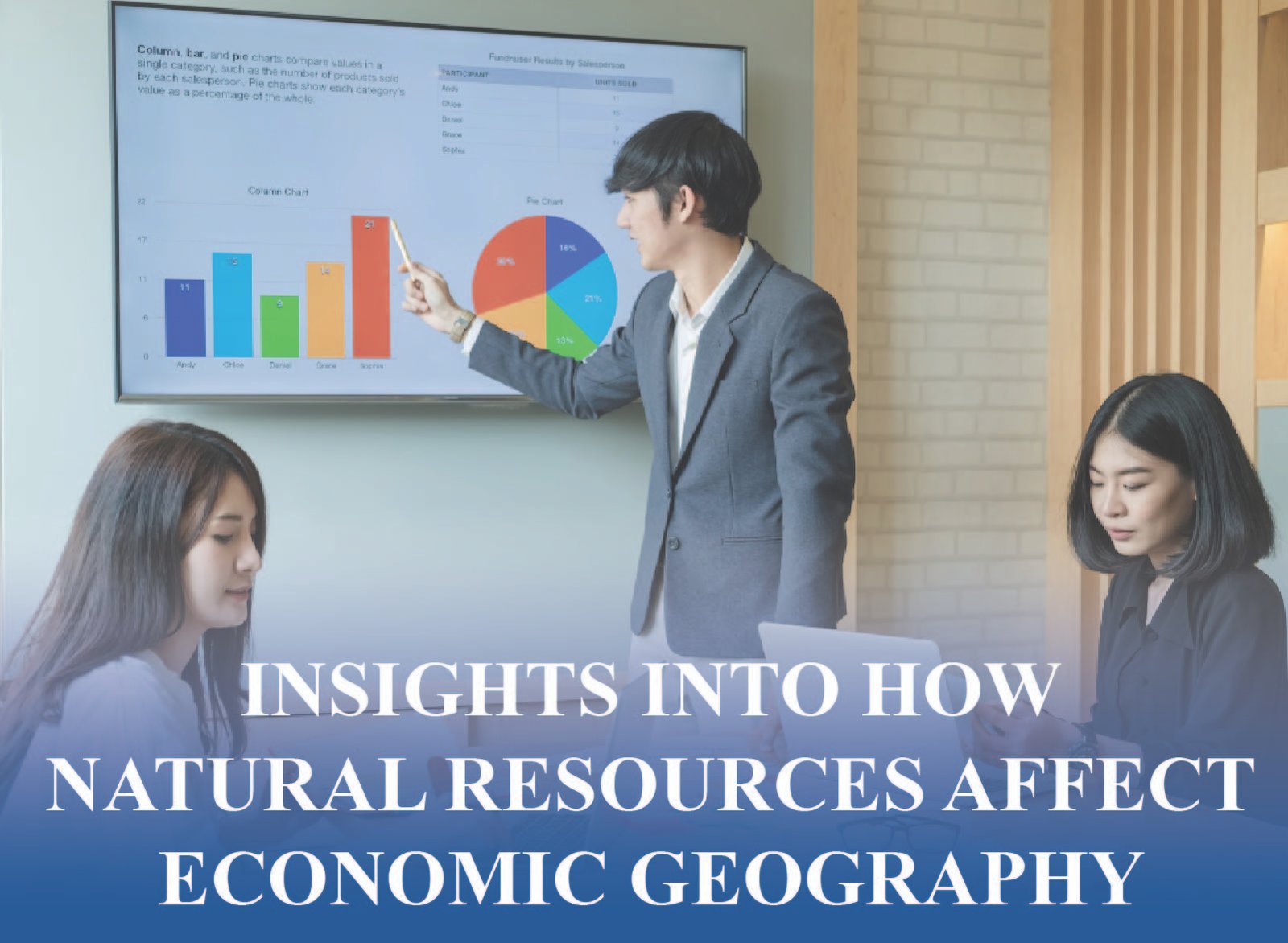
One of the building blocks in the formation of economic geography is the availability of natural resources. These natural resources are fossil fuels and minerals, arable land and freshwater, and they dictate the geopolitical policies of countries as well as where people and industries develop. Nations with oil deposits like Saudi Arabia are able to control the energy market and nations with agricultural prosperity like Brazil supply the world with food. Having such resources can greatly impact GDP, the development of the infrastructures and even international trade routes. Yet, the eccentrically distributed resources of the world depict intense economical differences among the areas.
Some countries have excess wealth because they are naturally endowed; others are not much of a growth potential but depend on either innovation or external support. Also there is the sustainability of these resources which are extracted, its environmental externality which introduces complexities in the long term economic planning. Thus, the impact of natural resources on economic geography can be used to interpret inequality in the world, trade relationships, and industrial patterns. This paper will discuss the influence of resources on the economic landscape in the world in detail.
Natural Resource Endowment and Economic Potential
The presence of a great amount of natural resources is one of the most important aspects of the economic potential of a nation. States, which have oil or arable land or valuable metals, will be able to build industrial foundations, earn investment money, and provide exports. Not every country with abundant resources can be considered prosperous though. Effective governance, environmental protection and the existence of good infrastructure are the keys to success. Natural wealth can either arouse corruption or even conflicts without proper management. This part dwells upon the role of natural resource endowment in determining the development course of a country and its place in the world economy.
Oil and Gas as Economic Drivers
Countries such as Saudi Arabia and Russia rely on oil and gas as the driving force of their national income into the economy. These are sources of energy to industry and exports but the dependence causes fluctuation. These fluctuations in price may lead to budget crises or bust cycles, so prudent fiscal policies and diversification strategies are needed as means to maintain stability and growth in the long term.
The Food Security and Agricultural Land
Arable land improves the production and decreases the level of food dependency. Nations such as Argentina and India are endowed with arable soils that would help in satisfying domestic demands and in exporting products. A good agrarian sector promotes growth and employment. It is necessary to invest in sustainable agricultural practices, irrigations, and climate-adaptive technologies in order to maintain yields and guarantee food security in the conditions of changes in climate at the global level.
Potential of Water Resources and Hydropower
Agriculture, energy, and the city use water. Norway and Canada are some of the countries that use rivers as a source of clean hydro-power which helps in economic independence. With freshwater, food security is enhanced and growth aids. It is very crucial to manage and well preserve lakes and rivers so the environment is not degraded and water may remain a major economic and ecological asset.
Forests and Timber-Based Economies
Forest-rich nations such as Brazil benefit through the production of timber, pulp and biomass. These industries promote employment and trade, yet forests are at risk of being destroyed. Some practical ways to combine economics and preservation include responsible logging and reforestation. Sustainable forest management ensures the sustainability of biodiversity and economic sustainability.
Mineral Reserves and Industrial Growth
Copper, cobalt, and lithium minerals are vital to the technology sectors. Nations like the DRC and Chile take advantage of these reserves. The process of mining builds employment and infrastructure but in case of bad regulation there may be pollution or exploitation. Sustainable mining promotes inclusive development.
Geographic Distribution of Resources and Economic Disparity
The availability of natural resources all over the world is not fairly distributed. This is not a balanced distribution that determines the economic inequality and the regional type of development. Nations with a lot of resources have the chance to be industrialized rather quickly, whereas nations that are poor in resources have the chance to be imported and exist at a pace of slower growth. Geography also influences ease of access and exporting of resources and cost. There are infrastructure, transport routes, and terrain that influence the extraction and transportation of resources. Nations have to operate in such geographical realities in order to compete with other nations. This part discusses the role that geography plays in making winners and losers of the economic sphere.
Landlocked Nations and Resource Constraints
The landlocked states usually have high transport expenses and restricted access to trade. Nations such as Niger depend on the ports of its neighbors hence increasing the prices of imports. These limits make them less competitive even when they have abundant resources. The growth of road, rail and regional cooperation with investment would overcome the geographic isolation.
Resource Clusters and Regional Hubs
The presence of natural resources has the capability of making regions into economic centers. Texas oil fields or oil sands of Alberta contribute to employment, infrastructures and services. Such clusters are the magnet of investments and innovations. All of these contribute to driving economic growth, although intensive regions of resources may restrict their diversity and flexibility.
Agriculture Deterioration and desertification
Desertification leads to decreased arable land posing risks in the food security and livelihoods. Erosion of the soil in areas such as Sahel is accompanied by long droughts that result in low agricultural output and economic insecurity. These effects can be fought with climate-smart agriculture, tree planting, and sustainable water management. Such measures aid in the conservation of arable land and sustenance of regimes in the high-drought areas over the long term.
Accessibility Problems and Mountainous Terrain
Mountainous areas, like in Nepal or Ethiopia, have severe problems with infrastructure and means of transport. Hilly areas tend to separate communities, which slows down economic growth due to lack of mobility to the markets. Improving connections in the region by network of tunnels, air conduits and enhanced roads will minimize isolation and strike trade, opening economic potential to other regions by ameliorating remoteness and investment touch to some regions that are previously difficult to achieve.
Access to Restricted Resources in Coastal or inland areas
Beach countries have a direct access to ports hence exporting the resources becomes cheaper and quicker. Unlike the inland countries, there are high transit charges and logistics challenges that decrease competitiveness. Construction of rail, pipelines, and trade corridors would help fill this gap, improving access of landlocked countries to world markets and bringing more balanced regional growth.
Resource Management and Sustainability Challenges
Lucky natural resources can stimulate long-term prosperity, however, only in case they are used prudently. There is a threat that the richness of the country could become a burden because of overexploitation, pollution, and corruption. Lack of good governance in the extractive industries has the capacity to drive inequality and conflict. On the one hand, there are benefits that are brought in by the biased countries which ensure sustainability of policies. Protection of the environment, equitable remuneration, and transparency assist in coordination of resource use with development. Sustainability is also increased through innovations in energy, mining, and agriculture. This segment looks at how resource management is a determinant of effectiveness.
Resource Curse and Economic Instability
Depending on the quantity of natural resources, countries with huge reserves can suffer economic insecurity, corruption, and poor growth This is referred to as the resource curse. Nigeria with its oil riches has been trying to translate dollars into general prosperity. To solve this problem, there needs to be economic diversification, good governance, and more open governance to make sure that resource revenues are used to promote long-term development, which is inclusive.
Environmental Degradation from Mining
Irresponsible mining activities can also cause some heavy environmental damage like deforestation, water and air pollution. The catastrophic patterns of mercury pollution due to gold mining have been seen in Peru, such as damaging ecosystems and threatening human health. Sustainability in exploitation, stringent climate regulations, and social monitoring are important in the effort to reduce exploitation and achieve economic gains in tandem with ecological conservation to benefit future generations.
Renewable Resource Investments
Nations are putting money into renewable energy forms like geothermal energy in order to cut down their usage of fossil fuels as countries like Iceland. These clean energy powers have been a long-term stability, reduced carbon emission and energy independence. Green infrastructure investment also involves job creation and assisting the nations to enhance their environmental governance and the economy to extreme climatic shocks.
Community Rights and Resource Sharing
Indigenous people and other communities tend to be close to precious natural resources. Giving them a say in decisions that influence them as well as getting them to enjoy the access to resources prevents conflict and creates an element of equity. More stable, sustainable and ethically responsible economic growth based on natural wealth is the result of the recognition of rights to land, payment of reasonable compensation and the inclusion of locals in the development planning.
Transparency and Resource Governance
Open management of natural resources will enhance the citizens’ trust and develop the countries. Such initiatives as the Extractive Industries Transparency Initiative (EITI) facilitate open contract, revenue and operations disclosure. Accountability by governments and companies minimises corruption and the possibility that the citizens of a country will enjoy the wealth of their nation in an equitable way.
Natural Resources and Global Trade Patterns
The international trade is determined by natural resources due to the items that countries specialize in production and export. The most significant commodities such as oil, metals or grains are dominated by countries that consolidate important commercial ties. Trade, supply routes, and access to shipping is based on geography. When there is control over strategic choke points or export hubs, this makes it strategically important. In the meantime, the resource-based economy is exposed to fluctuation of prices. Countries want to balance between trade risks and maximality of benefits. This part discusses the attributes of resources and geography and how the two factors influence international business.
Strategic Resource Corridors
International energy distribution depends on such essential transport corridors of Strait of Hormuz and Suez Canal. Exports of oil and gas rely heavily on these corridors hence their use as strategic resources in international trading. Those nations that either control or have access to these routes have substantial economic and geopolitical powers. These corridors are crucial to the stable supply of energy, national security, and a smooth international trade in a growing global economy that is becoming firmly interdependent.
Export Economies Trusting on Resources
Nations such as the Australian one are rich in resources which include coal and natural gas that are exported mostly to the energy-thirsty markets in Asia. Nevertheless, such economies have grown too dependent on exports of raw material and to these pressures they become exposed to international market fluctuations and world price trends. To build resilience and decrease vulnerability, these countries need to diversify economically (in manufacturing, innovation, and service industries) as a way to build a more balanced, sustainable, and competitive long-term growth that is not threatened by volatile commodity markets.
Resource-Rich/ Resource-Dependent countries
Countries that produce raw materials are different from those that depend on imports to continue the increase of industries. As an example, China is reliant on minerals in Africa and this determines the foreign policy of China and trade agreements. This performance leads to the overall interdependence of all the world countries, with the resource-rich countries gaining an upper hand, and the importers devising means of acquiring the needed supplies.
Resource-Based Trade Imbalances
Raw materials and cheap finished products are normally sold by developing countries and imported finished products. This creates a trade deficit. This cycle kills home development and bleeds value. Investing in local production will restore trade balance, putting value in the exports as well as keeping the economic gains in house boosting better and self-sustainable economies.
Geopolitics of Energy Supply
Gas export is a political tool used by energy-rich nations such as Qatar and Russia. The ability to determine who controls energy assets determines alliances, power, and diplomatic advantage. The significant instruments of international relations are strategic reserves and supply security, as they can predetermine either cooperation or tension between energy producers and consumers.
Economic Transformation Through Resource Innovation
Technology is changing the manner in which nations are utilizing and exploiting the available natural resources. The innovations in renewable sources, digitizing mapping, recycling of waste, and eco-friendly technologies can lead to new ways of economic development. Instead of depleting nonrenewable resources, countries are now capable of making the most of the resources available by using inventions and clever alternatives. Such changes facilitate the sustainability, diversity of the economy and enhanced resilience against global challenges. In addition to that, resource-based innovation enables less advanced countries to leapfrog over crusty models and jump into clean as well as efficient industries. In this section, the tools, systems, and visionary strategies that are transforming the economic geography of natural resources in the age are brought out.
Technological Advancements in Extraction
Such modern methods as fracking and remote sensing enable one to extract natural reserves deeper and in more accurate locations. These innovations make them a productivity leader, as well as minimize wastes in operations, although they require them to be more stringent in terms of environment standards. By practicing responsible extraction of advanced sources, lengthy resource life is possible with minimal environmental impact to facilitate an even pace of development in resource-intensive and developing areas.
Digital Mapping and Resource Surveys
AI-enabled surveys and satellite imaging impose real-time information to manage the resources efficiently. The tools assist governments in monitoring the resource reserves, enactment of environmental laws, and avoiding illegal exploitation of the resources. Digital mapping can improve sustainability of the planning process through greater openness and efficiency in the governance of resources as well as enhancing investor confidence and enabling countries to react swiftly to changing supply demand conditions.
Resource Recycling and the Circular Economy
Recovery of metals and industrial waste limits new growth dependency and controls the harm to the environment by new extraction. Germany and Japan have circular economies that focus on reusing and innovation, which bring up green employment and reduce emissions. This sustainable practice enables nations to make more out of their natural capital and also leads to long-term economic stability and resilience.
Urban Mining and E-Waste Recovery
Copper, gold, and rare earth are examples of precious resources retrieved by urban mining through old electronics. This minimises the requirement of conventional mining that tends to be expensive and devastating to the environment as well. Urban mining enables recovery of waste into useful products to realize resource efficiency, local economic development, and environmental impact reduction of electronic waste.
Green Technology and Resource Substitution
Eco-friendly technology aims at substituting nonrenewable resources with options that are environment friendly. Green products such as electric cars, bio plastics and solar panels contribute to the reduction of carbon emissions as well as less demand on resources through strain on critical raw materials. Such innovations will result in more flexible economies, access to new markets and facilitate the transition to cleaner growth in developed and developing countries which is technology driven.
Conclusion:
To understand the economies that rise, static or fall, there is a need to look at the natural resources. Their accessibility, allocation and control influence national revenues, commerce, infrastructure and well being. Nevertheless, the regions which are the most prevalent beneficiaries depend on geography. Extraction, access, global integration are affected by mountains, deserts, and a coastal line. Furthermore, wealth may become a curse in case of bad leadership or exploitation beyond limits. Economic geography should hence factor both challenges and opportunities given by natural resources. With the world increasingly focusing on the concept of sustainability and innovation, knowledge of these geographic forces has never been more crucial than in the present day. It enables us to make more plausible plans and more fairly divvy benefits, and creates a more stable, global economy.
The knowledge of natural resources effects on economic geography will enable students, researchers and professionals to accommodate the global development patterns. In case you need guidance on a scholarly assignment, want to get supported with organizing, or are eager to enhance your research knowledge, professional assistance will enhance your results. We offer specific guides to writing in the field of economics, analysis of cases, and policy review. Never allow complicated stuff to drag you down, collaborate with us as we refine your ideas, enhance more clarity, and deliver a desirable work that will emerge out of the crowd.
FAQS
1: What is the impact of natural resources on economics on a geographical basis?
Their development affects access, production and infrastructure, which create industry location, trade routes and regional development.
2: What is the curse of the resource?
It is experienced when the resource-endowed nations experience bad growth as a result of corruption and monopolization in one sector.
3: What benefit does technology have in resource management?
It enhances extraction, monitoring and planning by using tools such as AI, remote sensing and digital mapping.
4: What is the point of recycling as a resource?
Recycling increases the life cycle of resources, lowers imports, and high considerations of green jobs and sustainability.
5: Why do communities have to be involved in the decisions about resources?
It is also equitable in compensation, minimizes rivalry and aids in the durable, protracted growth.
6: Do poor countries stand to gain through innovation?
Yes, they are actually able to jump into clean tech and jump over the old and polluting systems to grow.

To understand the geography influence in the world trade patterns, it is necessary to first understand the influence that the natural landscape, place, and access have to the flow of goods and services within a country to another. Trade Routes coincide with geographic issues, such as access to the coast, geography, and the distance to the market and in turn, these Trade Routes have an effect on transportation costs and international competitiveness. Coastal nations have the benefit of ports and access to the shipping lane of major Trade Routes, while landlocked nations have to pay higher logistics costs. Such natural obstacles as mountains or deserts make the infrastructure along Trade Routes more complex and expensive.
The weather affects farming productivity and the certainty of traditional commerce. Also, there is the closeness to sea highways or international Trade Routes which usually give the countries economical favors. The geographical disadvantages can be overcome through regional integration, infrastructure development, and increased participation in trade. Through the study of these elements, we can acquire a vital knowledge of the circulation of trade and the institutionalized forces affecting international economic activity.
Geographic Access and Global Trade Flow
The shape of the earth is a factor; location next to the coast or accessible rivers is a determinant in global trade. Nations that are situated along the coast usually have the advantage of seaports which lower the transport cost and allow faster access to the international markets. Conversely, landlocked countries have to use the infrastructure of the so-called neighbors, which involves additional expenses and more risks. River transport can also provide transport by water to the inland regions, which will give access to wider markets. The level of accessibility of geographic factors influences the volume of imports and exports, competitiveness of trade and economic diplomacy. Countries which build the infrastructure linking inland areas to coastal loci tend to integrate into world trade better. Geographic disadvantages can be met by strategic development.
Coastal Economies and Maritime Trade
Maritime trade and port infrastructure is of advantage to countries with long coastlines. Ports act as gateways of trade as export and import business are conducted at a cheaper rate and at a rapid rate. Cities with major commercial developments usually emanate by virtue of the logistics and access to the coast. Countries such as Japan, UK and Indonesia flourish through trade because of their geographical set ups of a coast. Having deep water ports and being accessible to international sea lanes is a great advantage in integrating them to global trade system, which augments GDP and trade efficiency.
Landlocked Countries and Trade Challenges
Countries without access to the sea are expensive to trade with since they have to rely on other states to access the ports. Lacking access to their own seas, they have to depend on adjacent transport systems and difficult international agreements. Other countries such as Nepal, Chad, and Bolivia face delays in transit, custom restrictions, and exposure to Political instability in countries in transit. Such issues curtail their competitiveness in trade. The best way to beat these structural disadvantages is through infrastructure investments, regional agreements and trade corridors by landlocked states.
River Systems as Trade Arteries
The presence of navigable rivers such as the Danube river, Mississippi river, and the Yangtze river helps drive efficient trade in inland economies. They facilitate low cost and energy saving transportation of heavy products. Trade centers are usually built at the river ports. Correct usage of rivers enhances the trade in the region eliminating congestions and leading to the sustainability objective.
Inland Connectivity and Logistics
Areas that are distant to the coast depend much on their own logistic systems to reach ports and trade centres. The efficacy of goods transportation between production and export hubs is ascertained by the presence of railways, highways and multimodal hubs. Under-developed internal infrastructure brings delays and increases expenses. Ordering countries such as China have invested heavily in the development of domestic logistics, connecting the furthest regions of the country with large seaports and enhancing the ability to export goods. High inland connectivity promotes balanced economic development and enhances increased global trade interaction.
Islands and Trade Dependencies
The geography of trade is a challenge to the island countries. They are also encapsulated by the ocean in that they rely solely on maritime and air transportation. High level of import dependency is common due to low level of production capacity in the country. Some of the countries such as Fiji and Maldives have to handle shipping schedules, costs and port structure. The supply chains are also exposed to weather disturbances in Island geographies. In order to guarantee trade resilience, such countries tend to enter regional trade agreements and invest in logistical facilities and online retail platforms.
Physical Barriers and Trade Constraints
Physical geography limits trade movement to a great extent. The unique features of the terrain in the form of mountains, deserts, dense forests and extreme environment could obstruct the emergence of the trade infrastructure such as roads, railways and pipelines. They cause a rise in transportation costs as well as restricting regional integration. The nations faced with poor terrain have to devote additional capital in technology, advancement, and international teamwork to evade their physical conditions. There also is a risk of natural obstacles that isolate the population and do not allow them to engage in wider trade processes. The strategies of addressing these barriers are important to ensuring equal access to trade and economic inclusion in the long run across regions.
Mountain Ranges and Trade Isolation
The existence of mountain ranges like Himalaya or Andes makes overland trade impossible owing to rugged terrains and unfriendly climates. Development of infrastructure in these regions is technologically challenging and expensive. Mountainous trade routes imply the usage of tunnels, bridges and, finally, the maintenance. This leaves far flung areas behind in economic development and market access. Although a few mountain passes can be used to trade on a seasonal basis, all-year-access is a problem. To create better connectivity and include such regions into trade flows, governments need to invest in specific engineering solutions.
Deserts and Infrastructure Gaps
Deserts such as Sahara and the Gobi create a hard challenge on trade. The location is arid and sandiness makes construction of road and rail difficult. There are also few people and extreme weather which discourage investment. Desert trade routes are expensive and need frequent maintenance. In North Africa, the transport corridors, trans-Saharan, are gradually taking shape, nevertheless, logistical challenges remain. The geography in a desert can cause a place to be economically marginalized unless counterbalanced by the presence of a nearby centre of trade or resource extraction. These limitations are necessitated by the use of innovative transport solutions.
Forests and Remote Borders
The presence of thick forests such as those found in the Amazon inhibit trade since their geographical features are challenging to navigate, their road network is expensive and their regulations regarding the environment are rigid. The nations should consider the use of sustainable transport like river and air transport to improve connectivity between these two regions and ensure they strike a balance between trade growth and the protection of the environment.
Permafrost and Arctic Logistics
In icy areas such as Siberia or northern Canada there are severe logistical challenges encountered in permafrost regions. Trade and infrastructure projects have limited construction periods, unstable terrain and are expensive. But climate change is opening up new corridors of shipping such as the Northern Sea route, which is changing world trading patterns. The development of the Arctic offers access to unexploited resources, but it will lead to more geopolitical competition. Sustainable trade in a region characterized by remoteness and fragile nature requires a responsible course of action and advanced technology to execute in a safe manner.
Natural Disasters and Disrupted Trade
There are earthquake prone areas which are more vulnerable to trade risks. Natural disasters interfere with the port functions, break the infrastructure and stop delivery. As an instance, tsunami in Japan or floods in Pakistan have led to significant trade disruptions. Weak geographies should come up with a disaster-resilient infrastructure, multiplicity of logistics, and emergency trade procedures. The reduction of the economic shock and trade continuity in disaster-prone areas, insurance, early warning systems, and international support must be maintained.
Strategic Trade Locations and Chokepoints
Certain geographic positions are strategic since they harbor trade chokepoints in the world. These are the thin-tubes of waters that are in control of the movement of a sizable portion of cross-border goods like canals and straits. Economic, political and strategic advantages can be gained by the possession of the countries of this region. The places are ports and make international trade possible, bringing investment, encouraging regional growth, and becoming geopolitically relevant. It is important to understand the role of geographic chokepoints when it comes to assessing the global trade risks as well as predicting the changes in trades.
Strait of Hormuz and Oil Trade
An important oil shipping route is the Strait of Hormuz lying between the Persian Gulf and the Arabian Sea. It carries close to 20 percent of oils produced worldwide every day. It has a small geography and hence it is a possible geopolitical flashpoint. Any instability in this will elevate world oil prices and affect the trade routes used in the transportation of goods. Nations that depend on oil production or oil imports pay close attention to the security of the strait. The ship operation and diplomatic ization are crucial in the stability of the trade in this region.
Panama and Suez Canals
Panama and Suez Canals transformed the shipping process worldwide as they saved on the time taken to transport goods internationally. The Suez Canal joins Europe and Asia, whereas the Panama Canal joins the Pacific Ocean and the Atlantic Ocean. These man made rivers reduce the cost of transport by billions of dollars a year. They are strategically controlled which has great economic benefits. Nevertheless, their susceptibility can be illustrated by blockages, such as the Suez obstruction in 2021. Current reforms of canals and canal management intend to enhance efficiency of the canals and somewhat protect against possible failures in world commerce.
Singapore and Global Logistics
Singapore as a country is sited at the junction between the Indian and Pacific Ocean making it a shipping and logistic hub across the globe. It has a prime deep-water port, efficient customs and its free-trade policies attract thousands of ships every year. The success of Singapore is the confirmation that strategic geography should be used with infrastructure, technology and governance. It serves as a transshipment hub of Southeast Asia, which is of important regional and global trade. It has a geographic competitive edge in export trade.
Gibraltar and Mediterranean Access
The Strait of Gibraltar represents a narrow shipping channel between the Atlantic Ocean and the Mediterranean Sea. It plays the central role in shipping between Africa, the Middle East, and Europe. Ownership of Gibraltar by the UK enables the country to have a strategic position in maritime commerce around the world. Both commercial and naval vessels go through this open neck, thereby, one of the most sensitive areas of navigation. It promotes the building of ports in surrounding areas and international logistics services.
Bosporus and Black Sea Trade
The Bosporus Strait in Turkey connects the Black Sea with the Mediterranean and therefore trades within Eastern Europe and Russia go through it. The geographic domination enables Turkey to control the naval commercial traffic. The significance of the strait has been enhanced as more energy is exported through the black sea. This location has helped Istanbul, which is at the crossroads between Asia and Europe to witness a booming trade, tourism and in finance. It is a key to political stability and navigation rights that enhance safe and efficient trade along this corridor.
Climate and Seasonal Trade Patterns
Climate determines the accessibility, stability, and the price of trade routes. Severe winters are capable of freezing roads and water and storm revenues interrupt shipping channels. Production cycles can also suffer due to climate, particularly in Agriculture and changing the Seasonal trade flows. Nation has to adjust to logistics and infrastructure to weather. Furthermore, the geographies of traditional trade are also shifting because of long-term climate change either opening the Arctic passages or threatening the coastal ports. Seasonal and long term climate effects should be understood to enable resilient and sustainable trade planning.
Winter Conditions and Overland Trade
Snow and ice in such countries as Russia or Canada may drastically impede the work of trucks and rail in winter. Trading becomes slow due to threats of overland in trade routes. Ice Roads provide a temporary fix which is not long-lasting. Winter trade interruptions occur, and require seasonal storage and alternative trade routes. The predictive modeling allows governments and logistics companies to change trade schedules and guarantee few delays. The design of infrastructure has to take into consideration violent weather so as to allow trade to continue throughout the year.
Monsoons and Port Operations
In South and Southeast Asia, monsoon rains put port operations, container operations and ship loading plans on hold. The floods damage the logistics in the land, and they delay the customs. Agricultural exports like exports of rice or tea do not take place at the desired time due to delays caused by the monsoons and hence due to its frequency and intensities. During monsoon peaks port operations tend to work on limited capacity. The upgrading of infrastructure, predicting climatic conditions, and automation of the ports are crucial in minimising downtime and ensuring that trade flows smoothly even during the monsoon season.
Hurricanes and Supply Chain Risk
The hurricanes destroy ports and logistics facilities in the Caribbean, Gulf of Mexico, and southeast of the US. They lead to delays of shipments, damage of cargo and shutting down of ports. The supply chains that have relied on these regions have to be able to have their contingency plans and shipping routes. Such ports as Miami or Houston invest in preparedness against disaster and insurance as a way to offset losses. Climate resilience plays an important role in maintaining trade in storm-affected areas. Hurricane trade disruption can be minimized by strategic location planning.
Drought and Waterway Shipping
A drought situation may also reduce the water levels in rivers and canals, which constrains the amount of cargo that they could carry. Such as the Rhine River in Europe and Panama Canal experience periodic droughts, which the container ship and a bulk carrier are subject to. The low drafts also imply less merchandise per shipment and high transportation expenses. This issue can be dealt with by climate-adaptive engineering like water-saving locks or dredging. Efficiency of the trade during dry periods could be maintained by monitoring the water levels and preparing along the way.
Arctic Melting and New Routes
The disappearance of ice in the Arctic has created new shipping roads like the Northern Sea Route along the Russian coast. These paths cut down the traveling time between Asia and Europe and they raise environmental and geopolitical issues. They also present a problem by means of safety of navigation, poor port infrastructure as well as insurance cover. As arctic ice caps keep melting, there is a possibility of a gradual shift in trade flows towards the north. International interaction and stringent control will be needed to keep opportunity and sustainability at peace.
Regional Integration and Trade Expansion
The geographical disadvantages can be alleviated through regional trade agreements and cooperation which has been shown to open access to new markets, standardize rules, and even share the infrastructure. The similarity of states that have geographical adjacency and economic compatibility is what promotes areas of trade that lead to heightened efficiency and competitiveness. Integrations such as the EU, ASEAN, or AfCFTA are some examples of geographic areas turned into an asset through integration. Such endeavors do not only open up market access but also develop reliable and resistant trade structures creating less dependence on remote and turbulent trade counterparts.
The European Union and Internal Trade
The EU minimizes trade routes barriers among countries that are located close to one another. Common rules, unified markets and free borders encourage large-volume and efficient exchange. Landlocked countries such as Austria enjoy sea access by nearby ports. This geographic and economic integration of the EU is a good example of how cooperation morphs the geography of the region into a communal gain. Intra-regional trade is facilitated by such logistics systems as pan-European railways, and the dependence on distant global connections. Geography is used as opposed to partitioned.
ASEAN and Maritime Economies
The countries with profound maritime intervals such as Singapore, Indonesia, and Vietnam are merged together in the Association of Southeast Asian Nations (ASEAN). Their geographic conformity facilitates maritime commerce and maritime port facilities. Customs harmonization and trade efforts that are cross-border lessen expenditures and time wastage. The success of ASEAN is demonstrated by the geographic clustering and strategic investment of logistical connectivity. Further investment in maritime infrastructure and trade technologies increases regional competitiveness and export opportunities across the globe.
AfCFTA and Landlocked Solutions
Trading access of countries such as Uganda or Burkina Faso is improved by the African Continental Free Trade Area (AfCFTA). AfCFTA already addresses geographic disadvantages by cutting down tariffs and enhancing transport corridors. Inclusive trade is facilitated by coordinated infrastructures such as railways during transportation of goods between the ports and capitals within the interior. Pan-African collaboration helps to change geographic fragmentation into opportunity. Certain harmonized policies facilitated a more streamlined process of customs and increased regional integration, which raised the barriers to many of the marginalized economies.
NAFTA/USMCA and North American Geography
It is possible to approach the North American Free Trade Agreement (now USMCA) since it uses the geographic closeness of three countries: Canada, the US, and Mexico. The common border areas encourage trucking, rail and cross border manufacturing. Areas such as maquiladoras in northern Mexico are using location based benefits and taking advantage of it in trade. The North American integration has been helping in nearshoring and effective supply chains. Competitiveness is increased by border infrastructure and harmonized standards. In this case, geography is a propellant to industrial synergy and the level of trade.
Silk Road and Eurasian Corridors
The Belt and Road Initiative (BRI) by China brings historical Silk Road ties between Eurasia once again. Asia, the Middle East, and Europe have newly built railways, roads and other pipelines. High-end investments improve geographic connectivity. Countries in the pathway receive better access to trade, development of industrial centers and transportation networks. Nevertheless, regardless of debt and politics, BRI is altering the geographic distribution of trade by opening inland and remote regions to trade. Long-term viability of these new corridors is guaranteed by strategic planning.
Conclusion:
Geography has been a determining factor of the global trade pattern. Physical and environmental variables impinge on the availability, productivity and risks of trade, and these include coastal areas and chokepoints, weather and geography. Economic advantages can be generated out of geographical constraints through wise investments that are strategic, local collaborations, and innovation. Knowing and adjusting to the geographic conditions, nations can improve their engagement in international trade, promote inclusive and sustainable economic growth.
The effect of geography on trade could not be neglected by a student of international economics, international policy, or even logistics. Are you willing to go further on your knowledge base or need to enhance your academic performance? You can do that by getting help from an expert. Stop being intimidated by complicated trade concepts- contact us today and stand your global trade analysis on a whole new level.
FAQS
1. What is the influence of geography in world trade?
It has an impact on access to ports, trade routes and costs of transport depending on location, terrain and climate.
2. What are the significance of choke points such as the Suez Canal?
They link large oceans and shorten the time of shipment with high stocks of trade world-wide.
3. What are the challenges of the landlocked countries?
Lack of their direct access to ports demands use of neighbors that increases the costs and delays.
4. What effects does climate have on trade?
Shipping, exports of crops, and reliability on transports are influenced by weather conditions and seasons.
5. Is regional trade agreement of any assistance?
Yes, they will be increasing access, reducing the prices and sharing infrastructure.
6. How are rivers involved in trade?
They provide inland transportation of heavy products cheaply and very effectively.

Interactions between geography and economy cannot be fully understood unless they are personally analyzed on the extent of influence of physical location, environmental structures and space relations on the performance of the economy. Geography has a direct impact on the economic potential of a territory in terms of the availability of natural sources, the vicinity to trade routes and the topographical facilities to build infrastructures and climatic conditions suitable to agriculture and to industry. It is not just this relationship of national systems of the economy, but also in terms of world trade systems and local growth trends in the economy.
This is a common occurrence when geography denies accessibility or economic opportunity so that countries stagnate or fail to develop consistently. On the other hand, the presence of favorable geography can be able to hasten development. This blog will help to define a systematic framework of how these geographical factors can be analysed in regards to economic outcomes and give a more insight on global inequality and trends in development.
Natural Resources and Their Economic Impact
Natural resources form one of the most important aspects of the economic development of a nation as they present the backbone of some national sectors such as the energy, manufacturing, agriculture sectors, or the sector of trade. Their natural distribution such as oil fields and mineral deposits to fertile land and forests contribute immensely to the economic orientation of a country. With rich, easily accessible resources, there is the potential of growth, investment attraction, and trade balance reinforcement. Nevertheless, effective management, infrastructure, and sustainable practices are required to bring about successful results. It can become high risk economically and environmentally in terms of mismanagement or excessive dependency. This part explores the role played by geographic endowments of natural resources in economic potential, its opportunity creation, as well as the risks that it might introduce.
Resource Availability and National Wealth
Wealth or lack of it in terms of natural resources plays a great role in determining the economic status of a nation. Countries that are rich in oil, minerals, or good land like Saudi Arabia or the United States usually utilize their natural resources to develop the country by means of trade and energy production. On the other hand, those with imbalanced resources can depend much on imports and that forces trade disbalances. Yet, the availability of the resources is insufficient since the value of economic advantage depends on whether they can be successfully mined, produced, and commercialized. The power of many resources in a country is wasted when it is mismanaged, corrupted or does not have the necessary infrastructure.
Export Economies and Dependency Risks
Mostly, the economies that are largely exporting natural resources can be exposed to risks associated with the movement of the global markets. As an example, oil-exporting countries such as Venezuela suffer economic crashes in case of plummeting oil prices. This dependency may cause economic weakness especially when there are some absence of diversification approaches. The proceeds of natural resources must be reinvested within areas like education, health care and innovation, so as to achieve sustainable economic growth. Some countries which do not do this thus become victims of the resource curse where emphasis on extractive industries replaces the need to develop other productive sectors.
Agriculture and Soil Fertility
Agricultural production is directly connected with fertile land which impacts food security, job creation, trade and many others. Countries such as India and Brazil have fertile soil and desirable climatic conditions within their boundaries and as such, the agricultural sector is robust. Productivity can however be compromised by soil erosion, excessive use and climate changes. In order to sustain the development of agricultural economies, there is a need that agriculture economies engage in agricultural technology and also implement sustainable land management strategies. This also increases economic sovereignty as less reliance on the international markets is needed to supply food.
Resource Distribution and Regional Inequality
There are unequal distribution of resources within a country which results in economic imbalance between regions. As an example, the southern parts of Nigeria, which are mostly oil-rich, are economically more fabulous than the northern parts of the country. Such regional disparity usually causes social dissatisfaction and undermines national integration. Governments need to introduce fair policies and infrastructure development initiatives which can level out the benefits of resources. The result of such failure may be internal migrations, over-population in urban centers, and permanent developmental imbalances.
Renewable Resources and Future Economies
The world is moving towards the idea of sustainability, therefore, the economic promise of countries with renewable resources, like solar exposures, wind corridors or geothermal hotspots, is newly missing. Countries whose geography lends itself liberally to cheap forms of energy, such as Iceland with its geothermal energy, or Morocco with its Long-Spires are prime examples of how future economic paths can be shaped by geography. The environmental effects which are mitigated by investing in renewable technologies further offer a country a competitive edge in the green economy which is present worldwide.
Climate’s Role in Economic Activity
To the world, climatic conditions are of critical concern towards economic systems. It influences agricultural yield, energy use, tourist movements and infrastructure resilience. Areas that have stable and favorable climates tend to have increased economic reliability whereas regions affected by extreme weather conditions are at increased risk and uncertainty. Climate affects many areas, including droughts that disrupt crops, storms that break infrastructure, and many others. Such awareness can enable governments and businesses to develop dynamic strategies in line with resilience and sustainable development towards long term economic growth specific to a particular climatic situation. This section explores how economies are affected in many ways by climate and how consistent planning will be vital to the response to climate.
Climate and Agricultural Viability
Agricultural schedules and crop viability and productivity are characterized by climate patterns. Temperate or tropical countries (such as Vietnam or Kenya) may also grow throughout the year, which will increase their food production and enable export. On the other hand, countries with unfavorable climates can have few growing periods or have to invest heavily in irrigation systems and greenhouses. Climate and agriculture usually decide the livelihoods of people living in rural places, rates of employment, and national food security.
Climate Disasters and Economic Resilience
Infrastructural and economies can be ruined by extreme weather conditions like hurricanes, drought, and floods. These disruptions pose the greatest effect to developing nations who in most cases do not have a resilient infrastructure. To illustrate, Cyclone Idai in Mozambique ruined livelihoods and brought economic activity to a pause of several months. Long-term economic stability in vulnerable regions is necessarily associated with the necessity to invest in climate adaptation, early warning systems, and disaster insurance mechanisms.
Seasonality and Tourism Economies
Tourism is an important source of revenues to most countries but this is influenced by seasonal temperatures. Switzerland has both summer and winter tourism because of mountains and lakes and beach tourist destinations such as the Maldives depend on stable and sunny weather. Seasonal tourism may also be risky to the economy due to price fluctuations that occur during off-season or weather pattern changes as a result of climate change. These risks need to be addressed by diversification and sustainable planning of tourism.
Energy Demands and Climate Zones
Energy consumptions values are influenced by climate- colder places need more heating and warm areas cooling needs. Such requirements define energy infrastructure and energy prices. Nations need to consider the affordability, sustainability and the domestic energy demands. Countries with warmer weather conditions are also turning to solar technology to fulfill their energy requirements, appearance in industry and homes, having found attractive alternatives to meet energy resources at an affordable cost, as well as sustainability.
Climate Change and Economic Adaptation
The changes in climate patterns in the whole world are changing the amount of rain that is received and levels of the sea and changing temperatures, all of which influence economic activities. Agricultural areas could change, fisheries could decrease and urban structures could be exposed to flooding. The country investing in adaptation technology and infrastructure like flood defense or improved crops will be placed at an advantage to continue economic growth. Climate data should be incorporated into economic planning to survive in the future.
Geographical Accessibility and Trade
Accessibility is an important factor that is used to establish the success of a nation to undertake efficient trade and economic exchange within the context of geography and economy. It is often beneficial, due to logistics factors, that countries located near coastlines, the flows of some of the biggest rivers of the world, or having access to important trade routes, will have lower shipping rates and easier access to the market. On the other hand, a landlocked or isolated area has an expensive cost of transport and has to rely on the availability of other nations to allow them to trade.
Such geographical limitations may hamper the development of the economy unless overcome with powerful infrastructural development, interregional interaction and intelligent investments. This section examines the role of accessibility in the dynamics of trade and why spatial planning plays a necessary role in the economic integration and development opportunities of a country.
Landlocked vs. Coastal Economies
Sea land countries tend to get access to international markets in better ways and at low costs since they have access to seaports which make it easy to trade. On the contrary, in landlocked countries such as Chad or Bolivia, there are logistical problems that increase export-import expenses. Such states rely on console transit channels that tend to constitute complicated diplomatic and infrastructural arrangements. In order to overcome these barriers, landlocked economies should build their strategic plans and regional collaboration.
Strategic Trade Locations
Nations located along international trade shipping routes, or trade bottlenecks frequently evolve into economic centers. Countries like Singapore and Panama are good examples of those who benefit a lot because they control maritime passages. In the areas, they are strategically located to attract foreign investment, to build port infrastructure and to promote integration into the global trade. Geography emerges to be an asset that leads to consistent economic relevance on the global scene.
Infrastructure and Terrain Challenges
The presence of mountains or otherwise rough terrain may curtail the progress of the transportation infrastructure and make doing business to be more expensive. Nations such as Nepal or Ethiopia have problems with constructing the road or rail network due to challenging terrain. Such physical constraints isolate areas and inhibit movement of goods, labor and capital. These limitations will have to be overcome through infrastructure innovation and investment.
Transportation Corridors and Economic Zones
Countries, which establish effective transport corridors, like the Belt and Road Initiative developed by China, develop economic zones which attract growth in the region. Such corridors shorten travel time, woo investment and facilitate industrial clustering. The development of such corridors is geographically predetermined and, to a great extent, spatial planning determines the scope of the economic growth.
Urbanization and Market Access
Market access is already dictated by proximity to the urban centers among both the producers and consumers. City centers pool infrastructure, labour and capital, which allows economies of scale. These benefits are not common when the concerns are in rural areas far to the urban centers thus resulting in reduced productivity as well as the standards of income. This gap can be filled with the development of rural-urban connectivity, which spurred inclusive economic growth.
Topography and Industrial Development
Topography is an indispensable factor that affects the geography and economy of industrial development due to the effect of this factor on the ease of construction, transportation activities, and the availability of natural resources. Level topography means that infrastructure could be developed more easily and it is cheaper to develop and therefore suitable for large-scale industrial projects. On the other hand, rough mountains or irregular terrain usually involves complicated engineering work and increased investment.
Physical factors such as the river valley or mineral areas may give rise to industrial centres, which contribute to the geography and economy of a region. Understanding the influence of physical landscape on the feasibility of industries is extremely important in efficient planning, zoning and sustainable development, underscoring the intimate relationship of geography and economy. In this part, the author is dealing with the effects of topography on the industrial patterns and strategic choices for best utilization or exploitation of these geographical conditions.
Terrain and Construction Costs
The flat plains enable industrial development and urbanization to take place since the costs are less and there are fewer problems involving engineering. On the contrary, mountainous or hilly areas necessitate intricate preparation, tunneling or land alteration. These new expenses can discourage investing or hold up the industry. Thus, flat geography is usually associated with a rapid and less expensive industrial growth.
River Systems and Industrial Clusters
The rivers have always been in support of industrialization by offering such sources as water, transportation, energy. Ruhr Valley in Germany and the Yangtze in China are the best examples of how a system of rivers can enable industrial clustering. Availability of waterways lowers logistic expenses and promotes energy-intensive businesses. One way that the countries utilizing their river systems optimally enjoy is the fast regional growth.
Natural Barriers and Economic Isolation
Barriers to integration exist in the form of mountain ranges, desert or forest that isolates communities. An example is the Andes barriers in the South American continent that exist as isolated zones of underdevelopment. Addressing these obstacles via tunnels, bridges, and modern sets of transport attracts great investments but delivers great returns to the industry in terms of regional inclusivity and cost-effective transportation.
Mining and Industrial Geography
Topography determines the site and practicability of the mining activities. There could be mineral-rich areas in the mountains which are difficult to reach. Mines within the flat terrains are more viable in open-pit mines. Geography therefore not only defines the extent of available resources, but also equally defines their economical extraction and industrialization.
Industrial Zoning and Spatial Planning
Proper spatial planning utilizes the topographic conditions to zonalize the areas to be developed as industries, living places and conservations. Improper zoning causes traffic jams, pollution and wastage of land. The governments should combine geographical realities and economic goals to optimize the results of urban and industrial planning.
Regional Geography and Economic Disparities
Regional geography plays an important determinant role in the geography and economy of a country, influencing the economic inequality by the domination of resources, opportunities and infrastructure in different regions. Development also is unbalanced due to factors such as climate, terrain, proximity to markets, proximity to urban areas, uneven development of certain regions when compared to others. These spatial inequalities in geography and economy tend to cause chronic disparity in income, jobs and standards of living. By understanding the spatiality of such disparities, governments and organisations can create targeted policies to target regional problems. This part examines the role of regional geography in geography and economy and finding ways to improve more open and fair development through strategic planning and investment.
North-South Economic Divide
On the global trend, there exists division between North Hemisphere nations which have had better economic progress compared to their neighbours in the south. This effect is due to the past pattern of colonizations, exploitation of resources and technology that have paralleled some geographic regions. History and geography are intertwined to support inequality on a global basis.
Urban-Rural Economic Gap
Cities usually have a successful existence because of intensive investments, services and infrastructure. In the meantime, the countryside might be deprived of the means and the environment. Geography plays a role in this separatism whereby distant or inaccessible places, it is difficult to shock developments on such circles. This gap would be closed by implementing specific regional development policies.
Climate Zones and Development Patterns
There are high chances that tropical areas develop problems when it comes to disease, weather unpredictability, and soil constraints. By contrast, temperate regions had been known to have positive conditions to agriculture and settlement and this encouraged the early industrialization. Development has to recognize and combat geographic determinism through policy and innovation.
Border Economies and Migration Flows
Migration and labor activities are influenced by geography, more of the border areas. To illustrate, the Mexican border towns have formed industrialized areas owing to the presence of the U.S. Migration inflows also influence labor supply and demand as well as consumption habits and provision of public services. Balanced border planning and region policies makes such flows be used to the respective advantage.
Regional Integration Initiatives
Regional integration plans such as the European Union or the African Continental Free Trade Area (AfCFTA) are some of the efforts to minimize the geographic and economic differences by taking advantage of regional cooperation. These all encourage international trade, standardisation of rules and encourage common infrastructure. Integration converts geography as a constraint to an opportunity.
Conclusion:
Geography and economy are very deeply interlinked because economies are severely affected by geography. Whether it is the availability of resources, climate, accessibility or spatial plans, each geographic aspect contributes either positively or negatively towards economic opportunities and constraints. Understanding the relationship between geography and economy, but in a more subtle way, will allow more optimal policy making, research and practical approaches to development. Nations, which are able to achieve strategic utilisation of their geographical advantages and overcome shortcomings, are more likely to generate sustainable economic development, which is inclusive. Geography and economy seen from a multidisciplinary perspective gives us fundamental knowledge about global inequality, paths of development and distribution of economic opportunities in the world.
The role that geography and economy play in economic development is one of the essential knowledge for the professional, scholars, and citizens of the world. Not only do you get an edge when learning this topic in carrying out research and formulating policy; but also in studying exams. When you require assistance with your economic-geographic analysis, or even structuring your points, there is special assistance that may get you to a higher level of interpretation and expression. Never be ashamed of complicated ideas, get the academic assistance you deserve now, to achieve your success.
FAQS
1. What is the effect of Geography on the Economy of a country?
Geography influences economic performance such as availability of natural resources, trade routes, land and the climate. These aspects determine the way infrastructure is developed and the position of industries and trading possibilities.
2. Why is economic development dependent on natural resources?
Industrial life, agriculture and production of energy can be driven with natural resources. But economic gain is only achievable through good extraction, governance, and reinvestment into other areas such as education or infrastructure.
3. What is the economic consequence of climate?
Agriculture, tourism, energy requirements and risk of disasters are affected by climate. Good climatic conditions ensure all-year production, and harsh weather conditions may destroy infrastructures and destabilize the economies.
4. Which problems do landlocked states have in their trade?
Other countries with no access to a sea port tend to incur high transport costs and depend on adjoining countries to trade. The barriers can be overcome with the help of diplomatic cooperation and well-developed infrastructure.
5. What influence does topography have on industrial development?
The low land favours industries; the reduced cost of building structures and transportation. Rugged or mountainous terrain provides logistical problems that demand extra investment in infrastructure.
6. What is the cause of regional inequality in countries?
Unequal distribution of resources, climate and access to the urban centers presents an imbalance in development. To overcome such inequalities, specific investments and regimes are necessary and should be inclusive of the regions.

How Global Economic Geography Drives Market Trends

The Role of Geography in Shaping International Policies

The Role of Global Cities in Economic Geography

Understanding the Economic Geography of Emerging Economies

How Geography Determines the Location of Global Cities

Understanding the Global Economic Geography of Financial Markets

How Economic Geography Impacts International Investment

Economic Geography and International Trade Relations

The Impact of Global Economic Geography on Local Economies

Understanding the Geography of Global Trade Flows

How to Approach the Study of Economic Geography in University

How to Study Spatial Distribution of Industries

Understanding the Role of Transportation in Economic Geography

How Geographical Features Affect Agricultural Production

Economic Activities Based on Geography in Developing Countries

Mapping Economic Activities Across Geographical Regions

Understanding the Geography of Global Supply Chains

How Economic Geography Shapes Regional Economies

Regional Disparities in Economic Development and Geography

The Impact of Natural Landscapes on Economic Activities

Best Books for Learning Economic Geography to Build Strong Foundations in Spatial Economics
How Geographical Features Affect Agricultural Production

Key Concepts in Economic Geography for Beginners

How to Understand the Impact of Geography on Economics

Economic Geography Strategies for Sustainable Development
How Economic Geography Shapes Regional Economies

Understanding Economic Regions and Their Economic Activities

Tips For Studying Economic Geography Efficiently

Insights into How Natural Resources Affect Economic Geography

How to Analyze the Relationship Between Geography and Economy
Understanding the Geography of Global Trade Flows
How to Study Spatial Distribution of Industries
How to Approach the Study of Economic Geography in University
The Role of Global Cities in Economic Geography
How Geography Determines the Location of Global Cities
The Impact of Natural Landscapes on Economic Activities
Understanding the Global Economic Geography of Financial Markets
How Global Economic Geography Drives Market Trends
Understanding the Economic Geography of Emerging Economies
Mapping Economic Activities Across Geographical Regions
How Global Economic Geography Drives Market Trends
The Role of Geography in Shaping International Policies
The Role of Global Cities in Economic Geography
Understanding the Economic Geography of Emerging Economies
How Geography Determines the Location of Global Cities
Understanding the Global Economic Geography of Financial Markets
How Economic Geography Impacts International Investment
Economic Geography and International Trade Relations
The Impact of Global Economic Geography on Local Economies
Understanding the Geography of Global Trade Flows
How to Approach the Study of Economic Geography in University
How to Study Spatial Distribution of Industries
Understanding the Role of Transportation in Economic Geography
How Geographical Features Affect Agricultural Production
Economic Activities Based on Geography in Developing Countries
Mapping Economic Activities Across Geographical Regions
Understanding the Geography of Global Supply Chains
How Economic Geography Shapes Regional Economies
Regional Disparities in Economic Development and Geography
The Impact of Natural Landscapes on Economic Activities
-
 General Economic Geography Tips10 months ago
Best Books for Learning Economic Geography to Build Strong Foundations in Spatial Economics
-
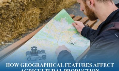 Geographic Distribution of Economic Activity5 months ago
How Geographical Features Affect Agricultural Production
-
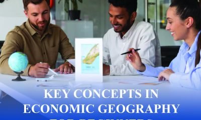 General Economic Geography Tips10 months ago
Key Concepts in Economic Geography for Beginners
-
 General Economic Geography Tips10 months ago
How to Understand the Impact of Geography on Economics
-
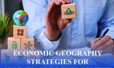 General Economic Geography Tips10 months ago
Economic Geography Strategies for Sustainable Development
-
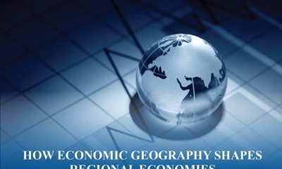 Geographic Distribution of Economic Activity5 months ago
How Economic Geography Shapes Regional Economies
-
 General Economic Geography Tips10 months ago
Understanding Economic Regions and Their Economic Activities
-
 General Economic Geography Tips10 months ago
Tips For Studying Economic Geography Efficiently


